


EKP V
$1,815.00
EKP V Multifunctional Display: the next step in the evolution of aeronautical GPS, redefining the role of the GPS inside the cockpit.
Panel-mounted and portable at the same time!
Even when cockpit-installed, it is always possible to remove the EKP V from the plane to use it with the internal rechargeable battery for updates, flight planning or training school debriefing.
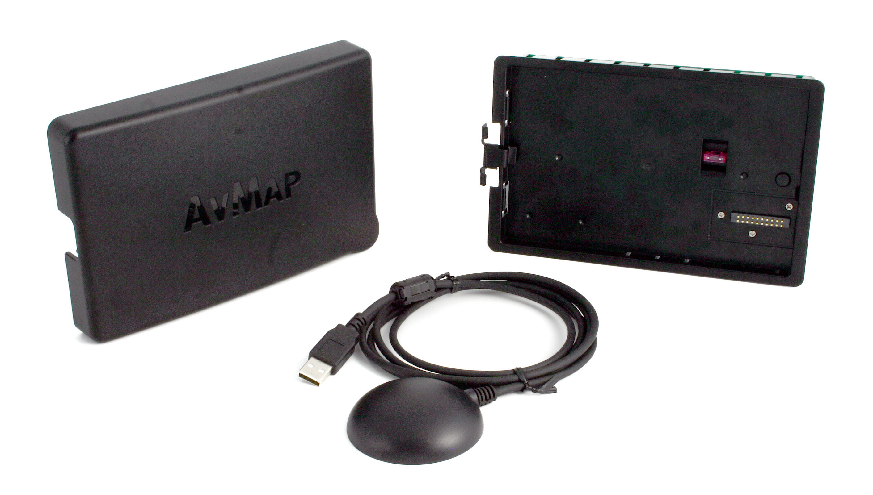
You can choose between: Cockpit Docking Station or Cockpit Cradle Kit
Light and compact
A brilliant 7” display, with removable battery and built-in GPS receiver, with a weight of just 14.1 Oz, covering an area of only 4.3” x 6.8” and only 0.8” thick!
Horizontal or vertical? Fully customizable!
You can choose the Horizontal or Vertical orientation. You are able to choose what to see and where to display it. You can even set different aircraft profiles and configure the F1 key with your preferences.
Advanced Navigation Technology
A comprehensive software, the result of 30 years of Moving Map and Navigation Technology Know-How. Navigation, Electronic Flight Bag, Primary Flight Display: all you need in a single device, developed with safety in mind.
AvMap Software provides advanced planning function, great situational awareness, and useful shortcuts in case of emergency.
Much more than a moving map: a true Multifunctional Display!
Through the Cockpit Docking Station, the EKP V can connect to: AvMap A2 ADAHRS, autopilot, weather receiver, CAS, video camera and other instrument, to create a complete flight information system.
Moving map excellence: super detailed, with the most reliable official data.
AvMap maps are the result of 30 years of navigation technology and vector maps know-how. Our aeronautical maps include:
- Aeronautical Database: Jeppesen data, Avioportolano, Letist
- Background: terrain depiction and Land Elevation for TAWS
- Terrestrial Database: street network and POI by HERE
- Airports diagrams & Approach plates: by Seattle Avionics
- FAA VFR sectional charts by FAA per for United States
Five available coverages: Europe- Africa, North America, South America, Asia-Australia, Worldwide.
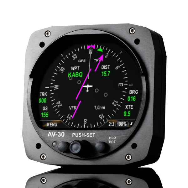
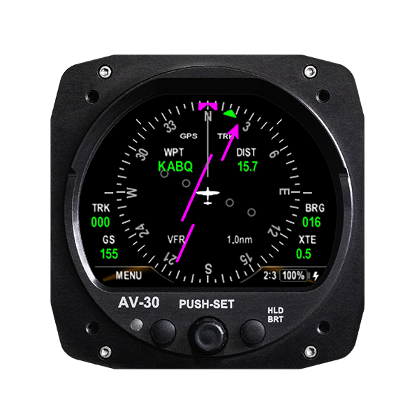
Get Airspeed, Altitude, Attitude and Heading on the EKP V’s 7” display
When connected to the A2 ADAHRS module, the EKP V turns into a full-featured Primary Flight Display providing:
- Airspeed and Altitude from Pitot-static system
- Attitude, side slip and heading information
- Integration of TAWS into the PFD with AGL Altitude indication
- Wind indicator with wind components
- Clear HSI display linked with EKP V flight planning function
- Customizable data fields
- PFD settings: Altimeter reference, Heading reference, Aircraft
- Specific V-speed reference value.
Features
Advanced Planning
AvMap Software provides advanced planning functions, the result of 30 years of Moving Map and Navigation Technology Know-How.
Maps customization
AvMap maps are made of vector objects, thus it is possible to customize them, selecting which objects to display at every map scale.
You can also build three custom map views choosing to highlight different data in each one, and then switch from one view to another with a click of the Cycle button.
You can even import to EKP V your own raster charts!
Situational Awareness & Safety
Navigation, Electronic Flight Bag, Primary Flight Display: all you need in a single device, developed with safety in mind. You can display on the map the HSI or the flight plan vertical profile, while the TAWS colors and the Airspace warning help you stay in cotnrol of the situation.
In case of emergency you can quickly search for the nearest airport and open the geotagged airport diagram and approach plate, and watch the plane icon move on it.
Connection to external instruments
EKP V is much more than a moving map: A true multi-functional display!
Through the smart Cockpit Docking Station, EKP V can connect to: AvMap A2 ADAHRS, autopilot, weather receiver, CAS, video camera and other instruments.
Content Management
With the AvMap Suite, you can manage with ease your EKP V contents: import and export your saved Tracks, Waypoints and Flight Plans. You can import flight plans from these popular flight planning services: RocketRoute, iFlightPlanner and Google Earth.
Hardware & Software
Hardware |
|
|---|---|
| Dimensions | 4.3” x 6.8” x 0.8” |
| Weight | 14.1 Oz |
| Display | 7” (16:9) LCD TFT, 64k colors |
| Display Resolution | 800 x 480 pixels |
| Display Brightness | 600 cd/m2 |
| Automatic Brightness Control | |
| Built-in high sensitivity GPS receiver with WAAS position accuracy |
|
| Micro SD preloaded with software and maps | |
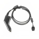
| Power supply | external 10/35 V DC with cable adapter |
| Battery | lithium-Ion, removable, rechargeable |
| Consumption | max 10 Watt |
| Speaker | |
| USB OTG master / slave | |
| Temperature range: -20+60° operative / -30°80° storage | |
| Cockpit installation: through optional Cockpit Cradle Kit or Cockpit docking station |
|
Software |
|---|
| Horizontal / Vertical view |
| Night Vision |
| Go to smart menu (cursor, Airports, VOR, NDB, Intersection, Address, POI, User Point, LAT LON) |
| Nearest Airport quick search |
| Set a street address as destination |
| Electronic flight bag: airport info, diagram and approach plate |
| Full flight planning capability, up to 15 flight plans of up to 100 legs each |
| Flight plan page with vertical profile |
| Vertical Profile on map |
| Airspace alarm and Flight plan Airspaces check |
| Full or split HSI / RMI screen with data fields |
| Full simulator functions |
| Fully customizable display: choose what to see and where! |
| Editable checklists to prepare your aircraft for the flight |
| Customizable profiles for each aircraft with different TAWS settings, map configurations etc. |
| SAR: Search and Rescue Patterns |
| Import and export flight plans, waypoints and routes from Navigator to PC |
| Compatible with the most popular flight planning services: import flight plans from Rocket Route, iFlightplanner and Google Earth |
| Free Software Updates |
Extensions available through Cockpit Docking Station |
|---|
| EFIS: when connected to optional A2 ADAHRS module |
| Traffic: when connected to optional Collision Avoidance Systems receiver |
| Video: when connected to optional video camera |
| Weather info: when connected to optional weather receiver such as XM WX Wxworx |
Maps |
|---|
| Jeppesen Database |
| Street Database by HERE |
| Airport diagrams |
| Approach plates |
| FAA VFR charts ( North America only) |
| Selective display: select which data to display at every map scale |
| Map cycles builder: create 3 customized map views choosing objects to be shown |
| Import your own charts through the AvMap Suite |
| Weight | 0.1 lbs |
|---|---|
| Dimensions | 0.1 × 0.1 × 0.1 in |
| Brand | AvMap |
You must be logged in to post a review.


Related products


skySensor TSO | ADS-B In, Certified Aircraft
skySensor is the perfect companion to skyBeacon, providing real-time ADS-B In traffic and weather data directly to your electronic flight bag (EFB). Designed for quick installation, skySensor mounts on your aircraft’s wingtip as a direct replacement for your existing navigation light, delivering enhanced situational awareness without adding cockpit clutter. Designed for both experimental and certified aircraft, skySensor offers a combination of features that make it an essential component of any avionics suite.

ADS-B Out Approved GPS Upgrade
Upgrade your current iLevil2 or iLevil3 unit with an ADS-B out Approved GPS. After your purchase, if you haven't done so already, you will need to send us your past generation unit and we will hold this order until we receive it. Once the unit is received, we will send back your newly upgraded unit.
Additional information on the certified GPS
- GPS source meets the position source performance requirements of §91.227 for ADS-B OUT in the experimental and light sport aircraft market.
- Ability to communicate with currently installed transponders (mode-s), to activate extended squitter, meeting ADS-B mandate for 2020 on experimental and light sport aviation.


Reviews
There are no reviews yet.